ODSW
Ensuring situational awareness in the near-earth space (NES) requires highly informative monitoring means, modern high-performing algorithms and software for controlling these means and processing data obtained through NES monitoring.

These means must provide for work not only with individual means, but with integrated information networks, thus ensuring, besides obtaining “single-time” data, the generation and updating of databases by space object (SO) parameters. In cooperation with the Scientific Center of Astronomy, VIMPEL Interstate Corporation developed ODSW (Orbit Determination Software) for planning SO observations using an optical means network, joint processing of data received from this network, generating and updating its own space object database.
ODSW FUNCTIONALITY
ODSW software system has the following functions:
- Planning of space object (SO) observations using a network of optoelectronic complexes (robotic telescopes).
- Obtaining SO parameter measurements, assessment of measurement errors and abnormal measurement filtration.
- Identification of measurements obtained through SO observations with objects from the database and determining the state vectors of their laws of motion.
- Initial determination of SO orbits and determination of the confidence intervals for orbit parameters (for any types of orbits), whether prior data is available or not.
- Prediction of parameters of the observed SO orbits, including the case of abnormal measurements.
- Accurate SO orbit determination based on the results of combining multiple tracks from different times, including those divided by a long time interval.
- Generation and updating SO database on the basis of observations.
- SO database analysis (history and statistics of SO parameter observations and measurements, detection and determination of the parameters of hazardous SO near collisions, analysis of SO flyovers above the specified territory, etc.).
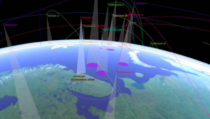
- Space environment visualization on the basis of observation and analysis.
- A wide range of means for space environment analysis, including:
- Geophysical data updating;
- SO track modeling;
- Assessment of the accuracy of measurements obtained using optical means and accuracy of ODSW computations on the basis of “reference” SO observations;
- Analysis of the effect of various external disturbances on the accuracy of SO parameters predictions.
ODSW IMPLEMENTATION AND USE
ODSW software system is implemented using general purpose computing means. VIMPEL Interstate Corporation and ASC have been using ODSW for several years to plan observations through their own network of robotized optical systems and maintain their own SO database. During the period of operation, deep testing and validation of ODSW have been carried out using model and actual measurements.
ODSW DELIVERY SCOPE
- Design project
- Technical descriptions of algorithms
- Source program code
- Test and validation program and methodology
- User manual